
Revolutionizing aerial measurements
AiroCollect revolutionizes terrain and building measurement by automating and digitalizing the process, leading to significant time savings and increased profitability. Traditional methods involving manual sketching, lasers and tape measures are replaced with AiroCollect’s efficient, drone-based data collection. This reduces the need for physical site revisits and enhances the safety in hazardous environments.
“We are now helping, for example, many companies in the solar and roofing industries to accelerate their project calculations” says Jan Leyssens from AiroCollect. “Our software also improves the accuracy and clarity of proposals, increasing the number of potential quotes and reducing disputes with clients and contractors.” By offering a visual and digital overview, AiroCollect is an invaluable tool for businesses looking to optimize efficiency and profitability in their projects.
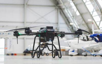
Seamless integration with small and accessible drones
“Drones are a great tool for aerial data collection,” continues Kristof Beenders from AiroCollect, “and we want to make this new measurement tool available for a wide range of users.” Therefore, the majority of AiroCollect users are now using lightweight drones (only 249 grams) such as the DJI MINI2, MINI3, and MINI4 to capture images. These drones are known for their user-friendly control systems and broad regulatory compliance. The free AiroCollect Android app enhances this experience by offering automated scanning, making the flying part of the process almost effortless.
Intuitive measurements
Once the images are captured, the measuring phase involves uploading them into the AiroCollect software. Here, the magic happens: the software stitches the images into a single comprehensive overview and a detailed 3D model. AiroCollect is fully cloud based and works on almost any device, so it’s not needed to install complicated software. In the intuitive, browser based, interface users can easily measure surfaces, distances, volumes… and generate summary reports. This makes it for example, very easy for a roofer to quickly prepare his quotations, a landscape gardener to start his design or a construction company to measure a pile of soil.
Sharing and collaboration made easy
AiroCollect’s sharing functionalities allow for easy collaboration and application of the collected data. Measurements can be shared with team members or utilized for creating detailed project quotes. Users can also export data to external software, facilitating various project needs, from generating PDF quotes to monitoring construction sites. This feature underscores AiroCollect’s versatility and its potential as a valuable tool in various professional settings.
Global aspirations and market scalability
The success of AiroCollect is a testament to Airobot’s deep understanding of market needs and its commitment to innovation. The software’s scalability and availability in multiple languages position it perfectly for international market penetration. With AiroCollect, Airobot is not just providing a tool; it’s offering a comprehensive, adaptable solution for aerial measurement, poised to transform practices across industries worldwide.